Landslides are among the most harmful geological hazards in mountainous and hilly areas of New Zealand, where they frequently cause significant damage and landscape changes. Monitoring the evolution of landslides and their subsequent impacts helps to mitigate the hazards that could arise in later reactivation phases or other similar cases. The abundance of time series remote sensing data has facilitated the mapping and monitoring of landslides. By applying object-based image analysis (OBIA), it was aimed to semi-automatically map the evolution of the Kaiwhata landslide and the subsequent impacts on the upstream area in the Wairarapa region in New Zealand using Sentinel-2 satellite data from 2017 to 2021. This work belongs to Kiarash Pooladsaz's master thesis for Copernicus Master in Digital Earth.

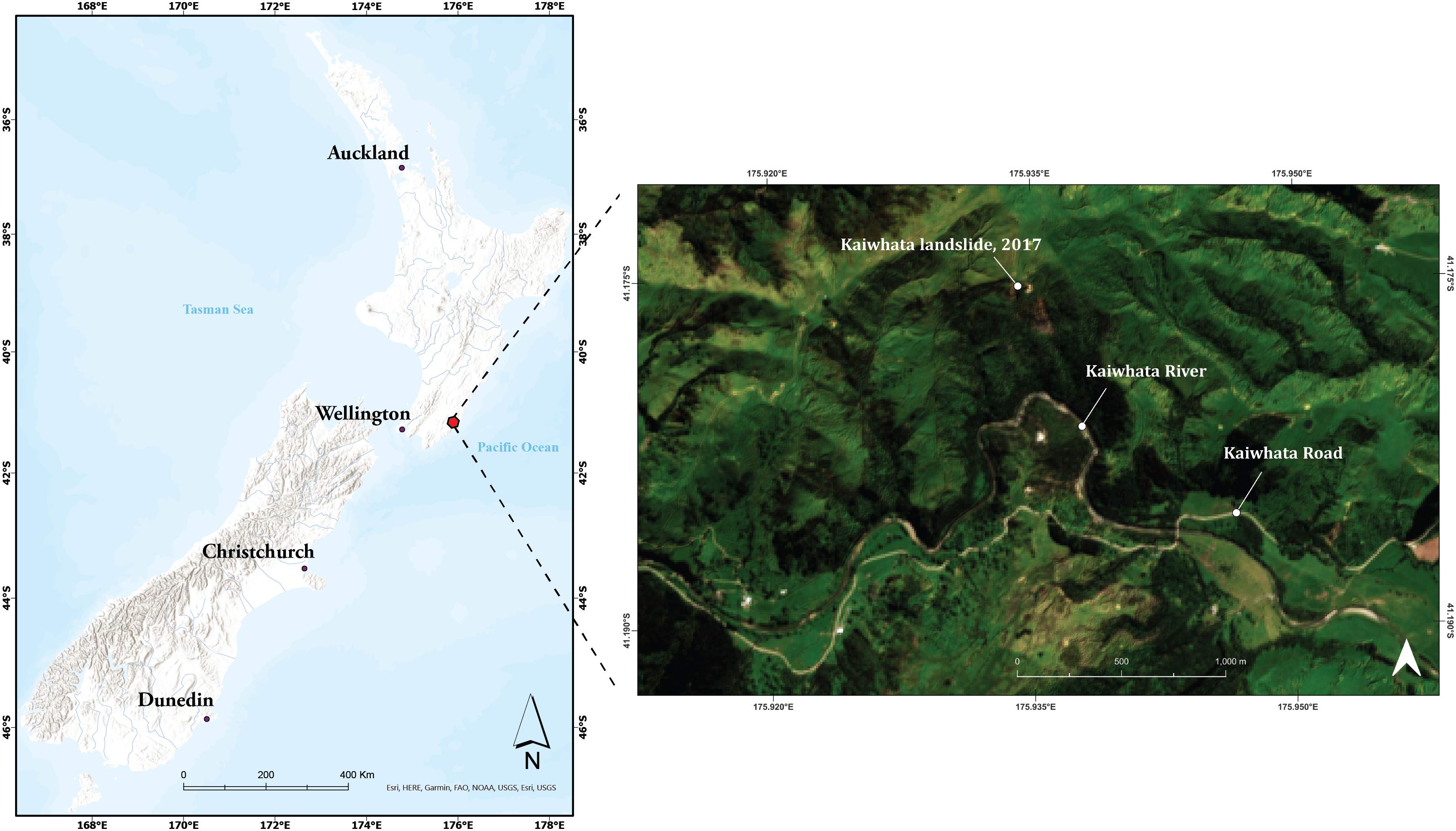
Kaiwhata landslide is located east of Wellington, North Island. The AOI covers 970 ha and is characterised by the Kaiwhata River and Road. The topography varies from 10 m to 500 m a.s.l.
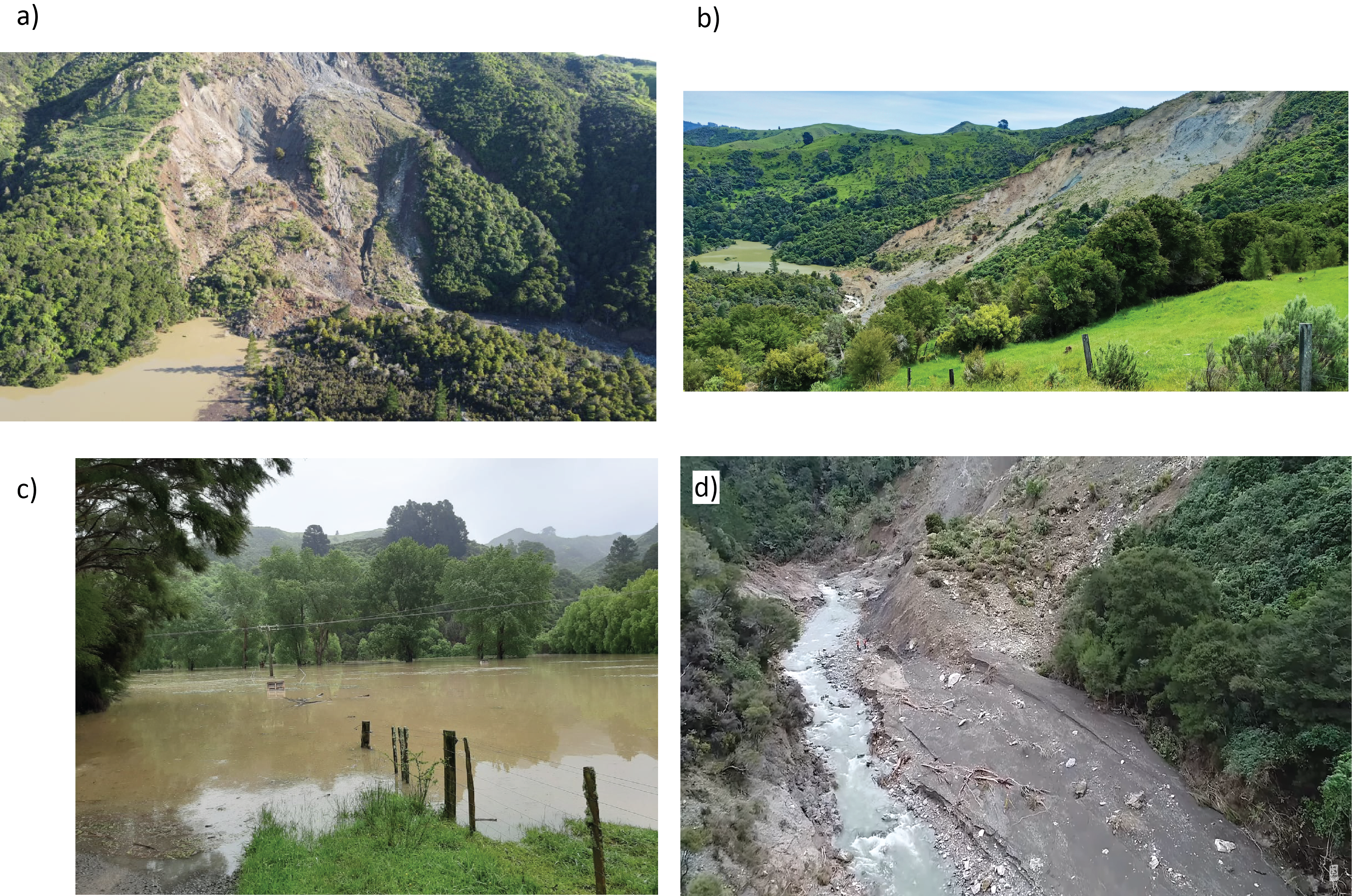
Initial landslide occured in 2017 but its extent was relatively low. However, the second and third landslide had huge impacts on the landscape:

Here is the overall framework of landslide and landslide-dammed lake classification. The ruleset follows several steps to attain and complete the desired classes. Each step consists of multiresolution segmentation, set of classification parameters, and class refinement. Meanwhile, we did not apply this overall ruleset to all the images, where the expansion of the landslide failure was accompanied by more sets of parameters and refinements. The value dedicated to some layers such as NDVI, DEM, and aspect are varied (VARIES) in different dates.
