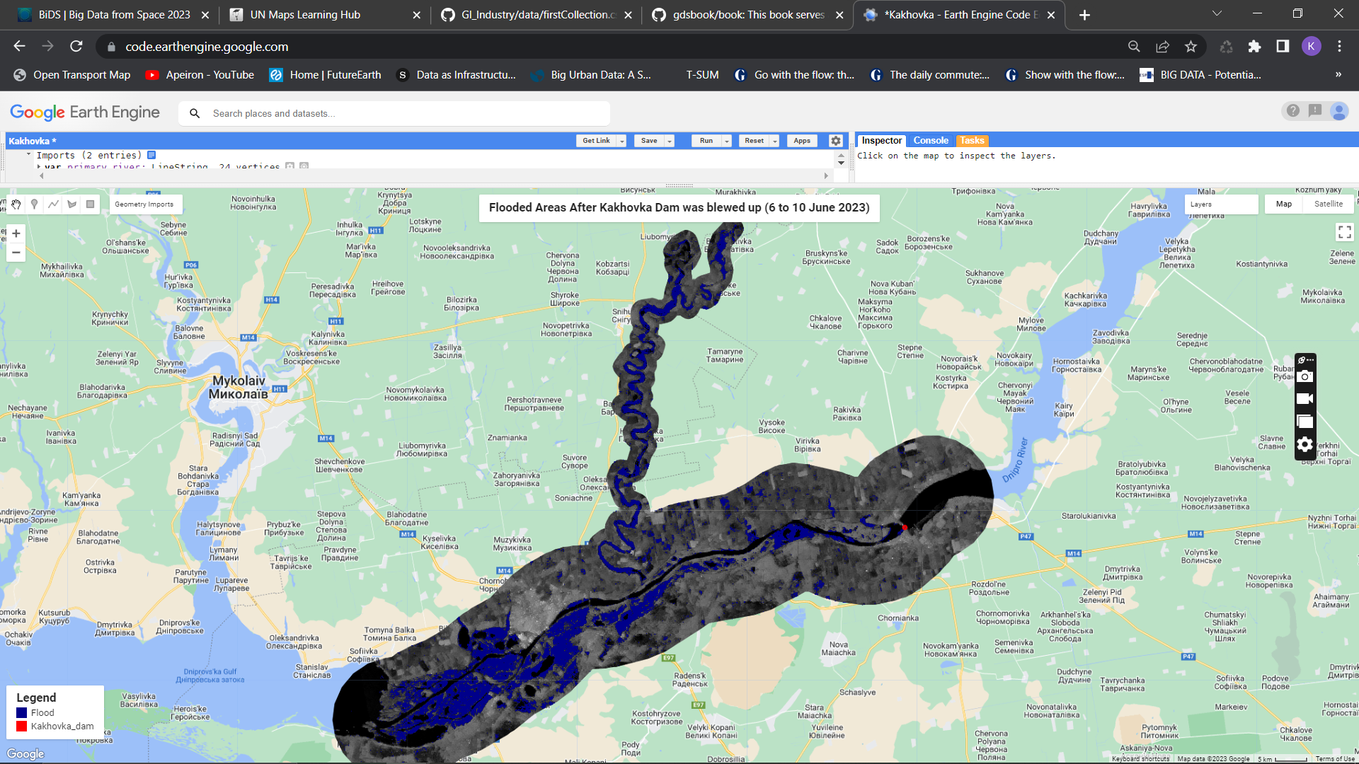
Mapping the Flooded Area using Sentinel-1 and change detection between 6 and 10 June 2023 with Google Earth Engine Code Editor.
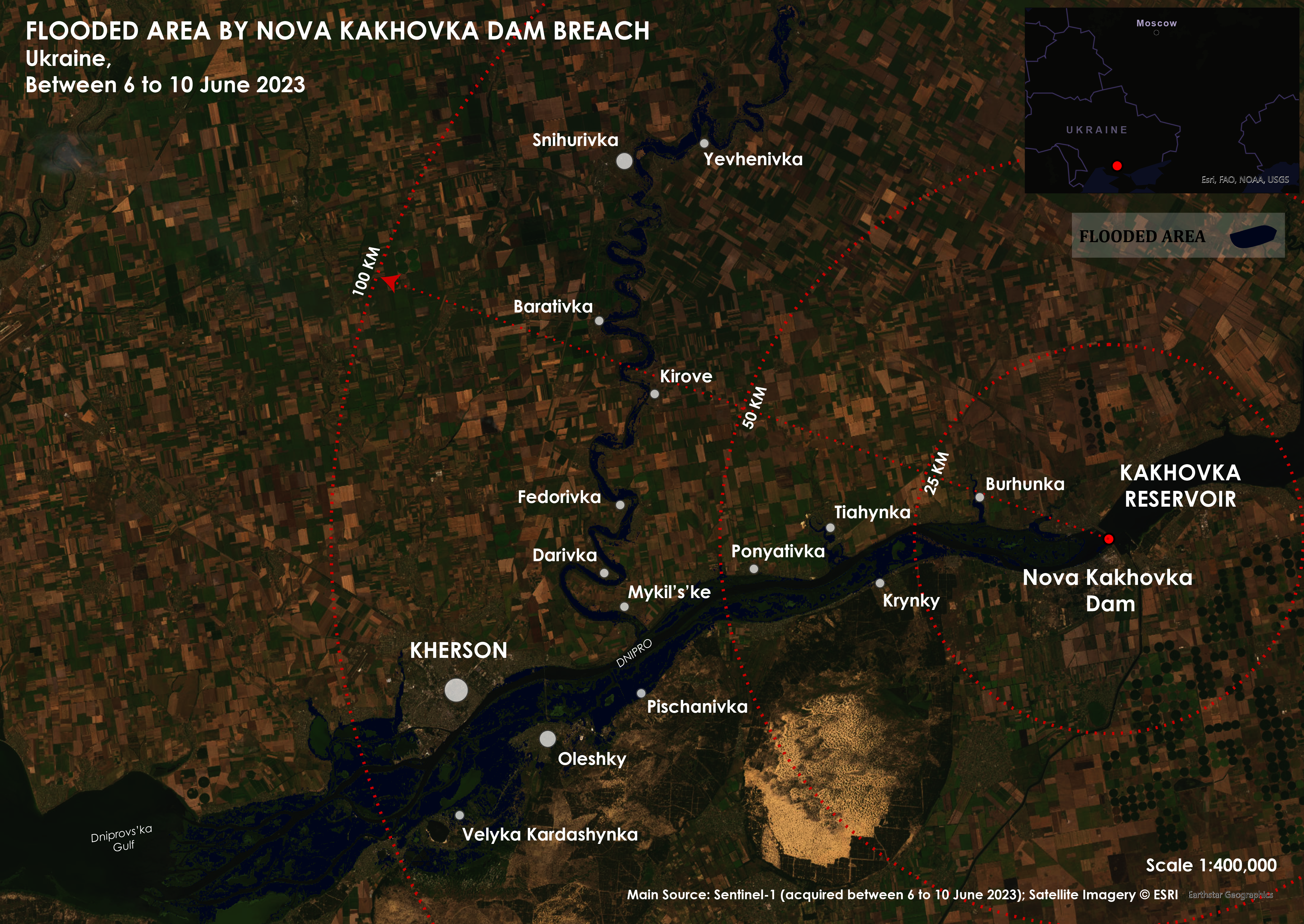
Kakhovka Nova Dam Breach
The explotion of Nova Kakhovka dam has caused severe damages to the infrastructure, adjacent cities and human lives. I decided to work with radar data using Sentinel-1 to map the flooded area between 6 to 10 June 2023.
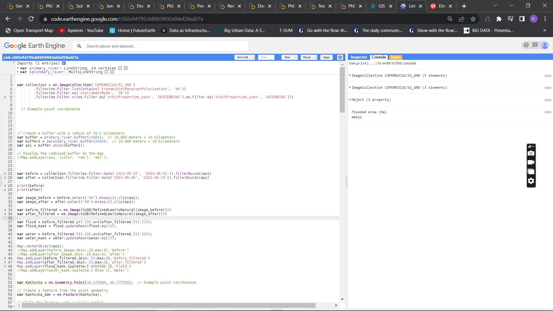
- defining image collection using COPERNICUS/S1_GRD;
- Region of interest was modified using 2 buffers along the main water streams, Dnipro river and Inhulets river;
- Two time periods were defined and single composite images were acquired by mosaicing the collected data, region of interest, and the MOSAIC function;
- Refined Lee speckle filtering was taken into account to reduce the salt-and-pepper effects in the collected radar data;
- A threshold was defined to distinguish the flooded areas based on the VH values of before and after images.
The result is not final and still includes misclassified agricultural lands that had low VH values in June but however, the results still provide suitable ouput. I decided to play with radar data to practice and gain experience with its principles and applications that will be continued more professionally.