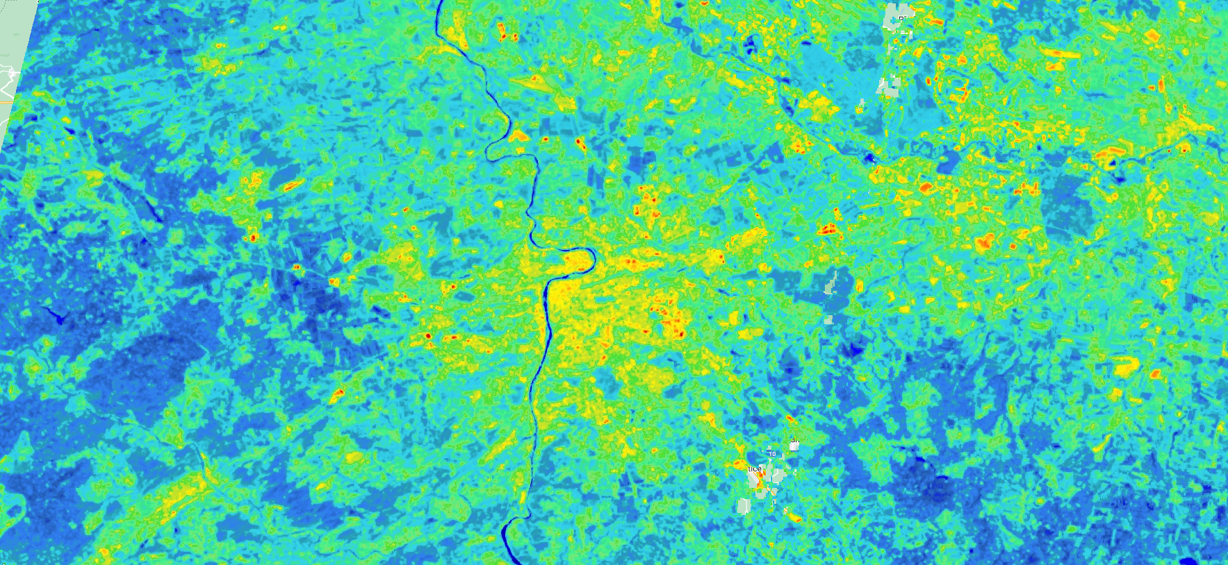
Nighttime Light & Urban Heat Island
Integrating nighttime light data, population distribution, and land surface temperature: comprehensive approach to visualise Human Settlement Patterns in Prague and Central Bohemian regions.
This E-portfolio intends to demonstrate collection of my academic practices and interests related to geoinformatics, spatial analysis, remote sensing, and geovisualization. The practices comes from studying Erasmus+ EMJMD funded programme "Copernicus Master in Digital Earth" that is divided to Geoinformatics at university of Salzburg and Geovisualization and Geocommunication at Palacky University Olomouc.
My Master thesis title is "Monitoring the Evolution of the Kaiwhata Landslide in New Zealand using Object-based Image Analysis and Sentinel-2 Time Series." You can access the thesis website HERE.
Integrating nighttime light data, population distribution, and land surface temperature: comprehensive approach to visualise Human Settlement Patterns in Prague and Central Bohemian regions.
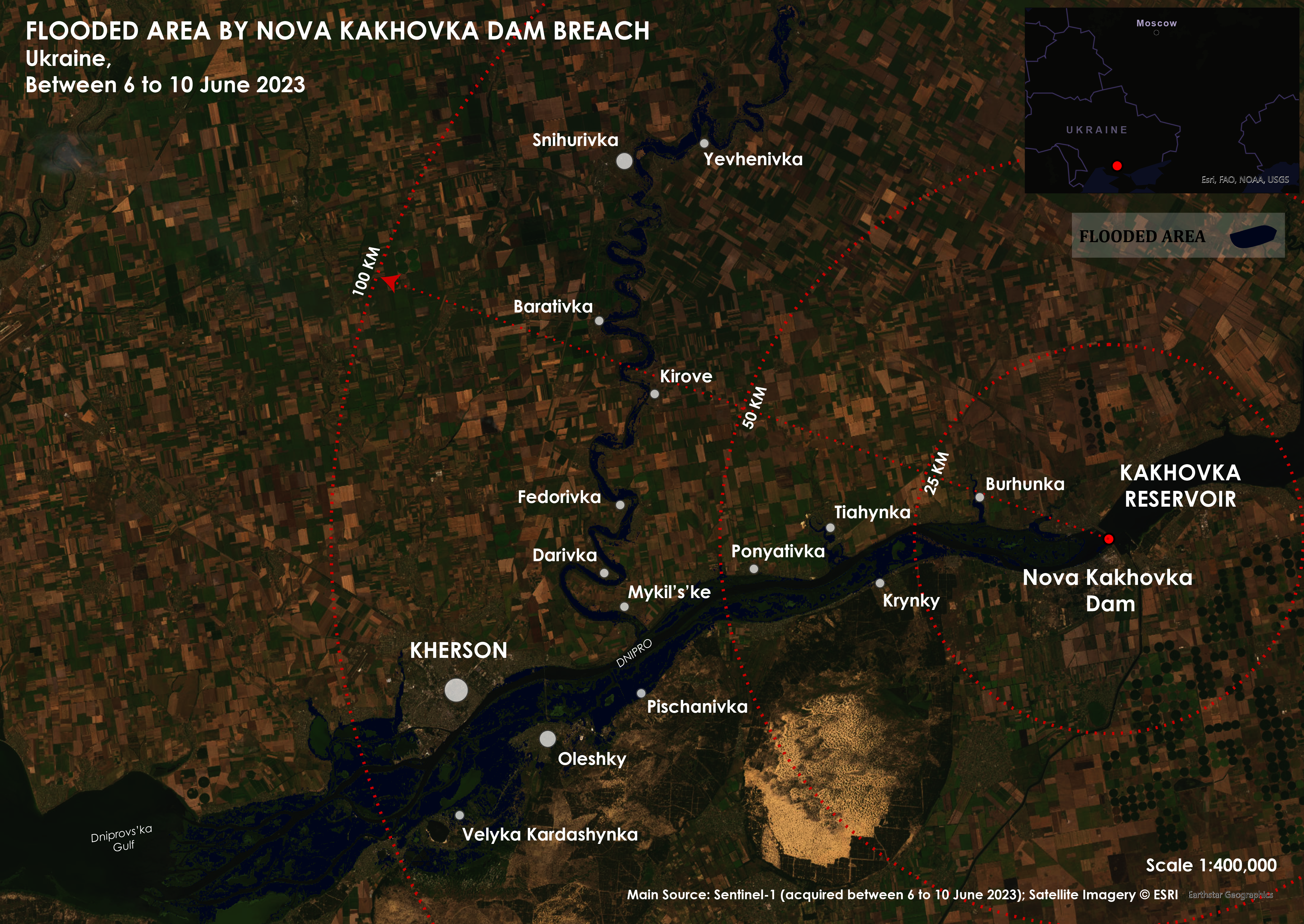
Mapping the Flooded Area using Sentinel-1 and change detection between 6 and 10 June 2023.
Paris Lodron University of Salzburg
Palacky University Olomouc