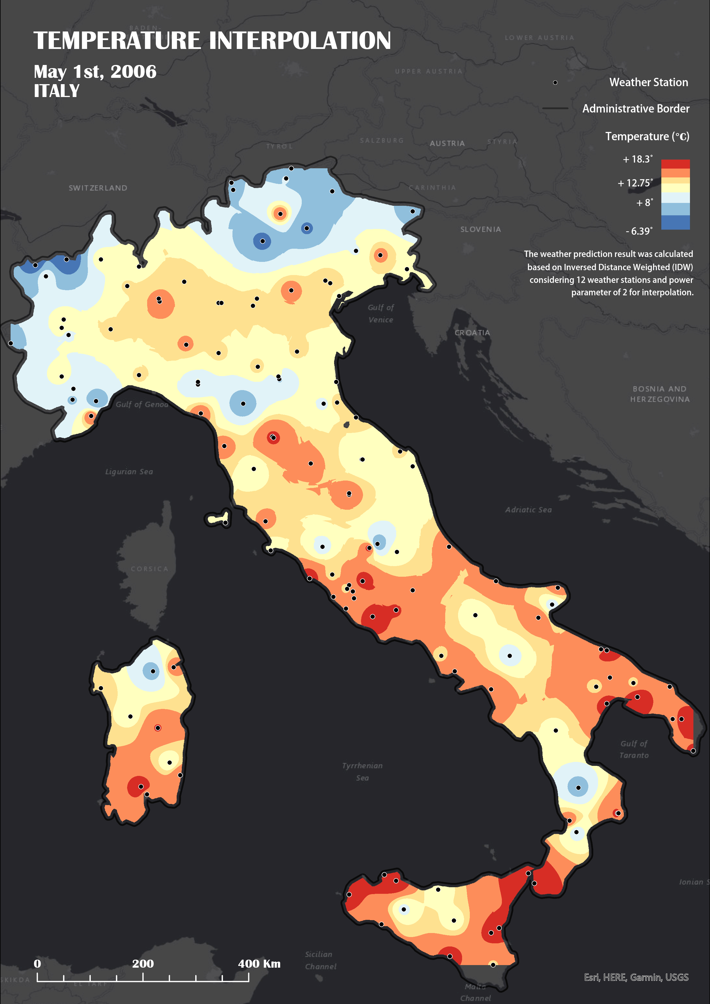
IDW Interpolation
Applying IDW interpolation and explore the modifications based on the measured temperature from the weather stations in Italy, 2006.

During this course, students got familiar with several topics that enabled to explore, analyse, and understand geographic data. Spatial interpolation methods such as kriging and inverse distance weighting allow to estimate values at unmeasured locations based on known data points, enabling the creation of continuous surfaces such as elevation or temperature maps. Surface analysis tools provide insights into terrain characteristics, including slope, aspect, and hillshades. Proximity analysis capabilities enable the calculation of distances and travel times between locations, identifying the closest facilities or creating service areas based on travel impedance. Network analysis tools facilitate route optimization, facility location analysis, and network accessibility assessments. Suitability modeling allows users to assess the suitability of locations for specific activities based on multiple criteria, such as land use, environmental factors, and infrastructure availability. These advanced techniques empower users to gain deeper insights, make informed decisions, and solve complex spatial problems. I introduced briefly some of the exercises and provide the links to get to know them in details.
Applying IDW interpolation and explore the modifications based on the measured temperature from the weather stations in Italy, 2006.
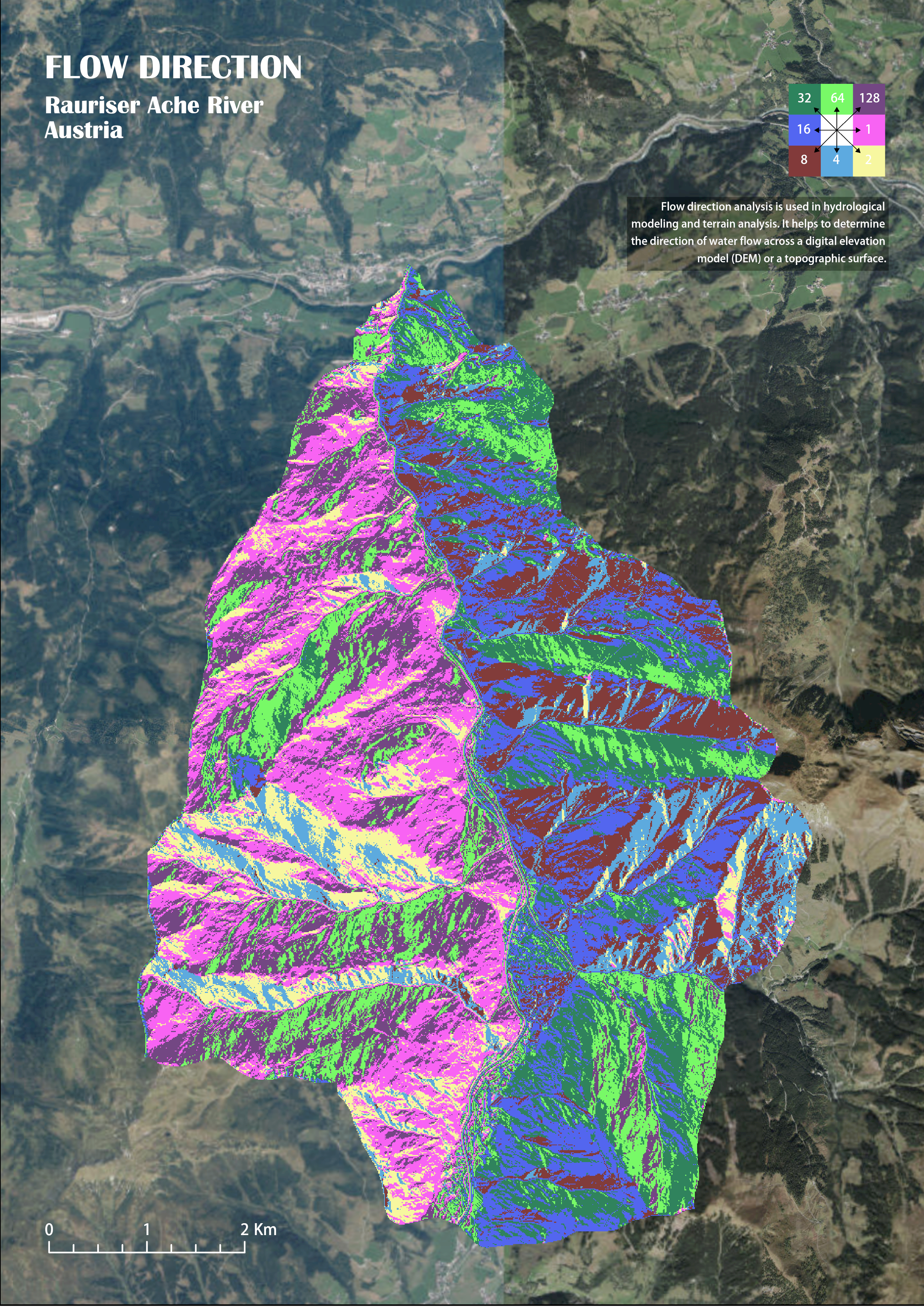
Exploring the surface runoff volume estimation based on topographic features.
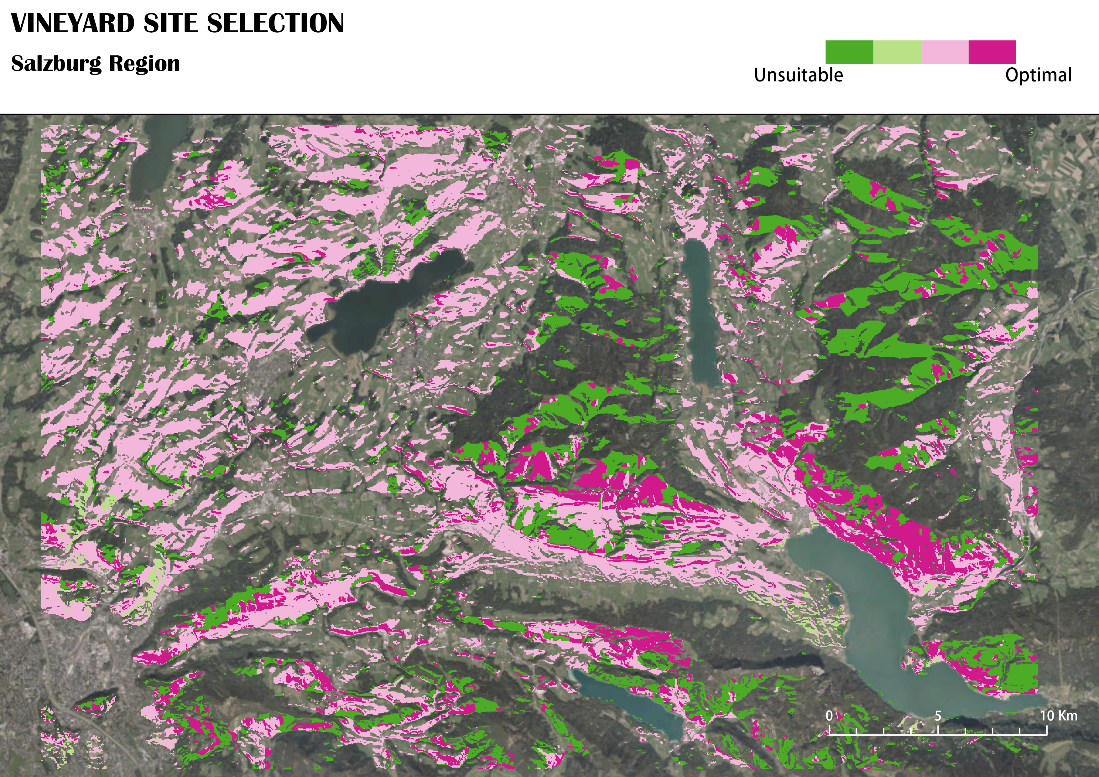
Vineyard site selection based on topographic characteristics, landuse, and sun radiation.