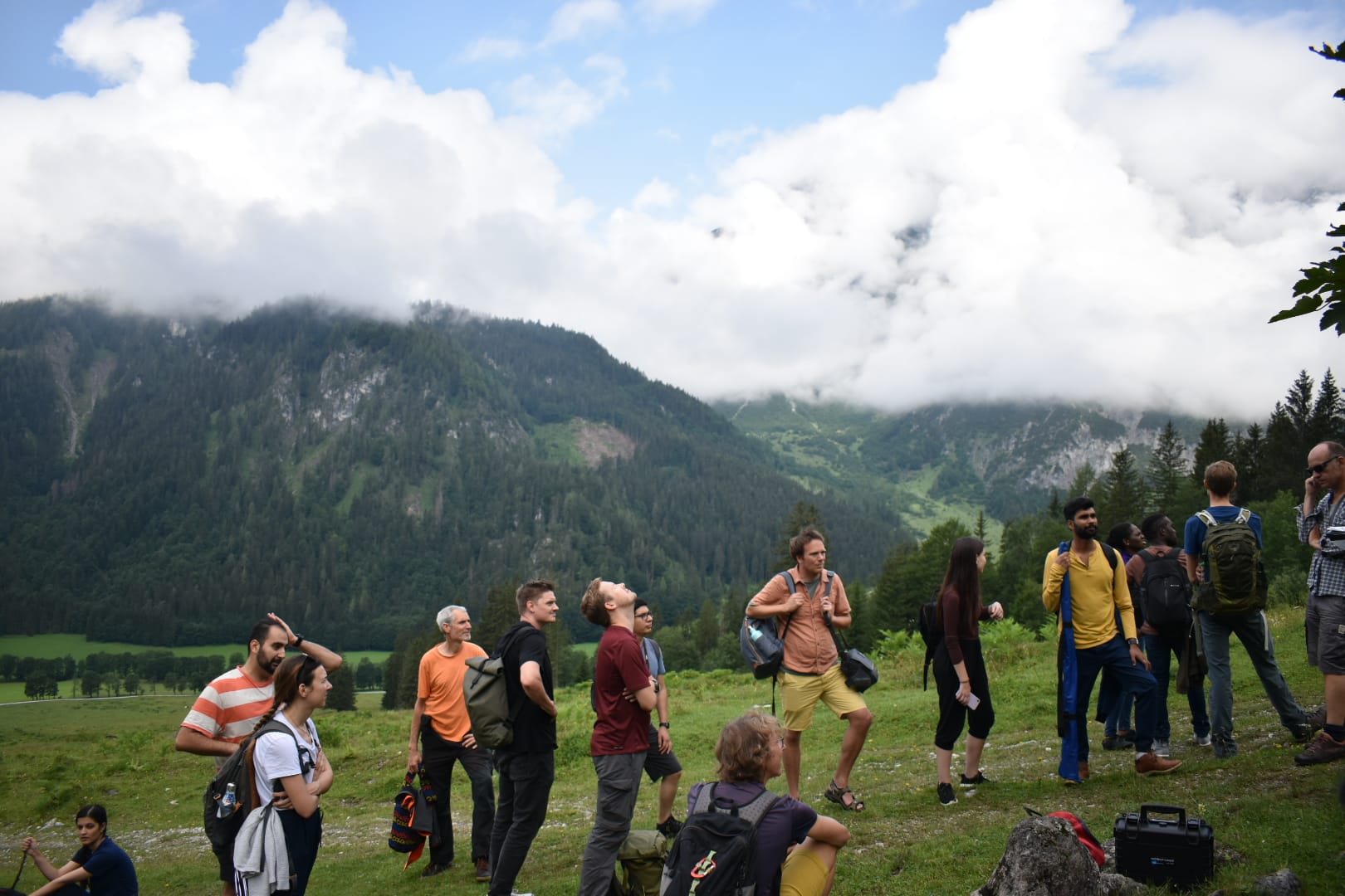
Summer School
Multi-sensor Earth observation in practice, held by Paris Lodron University of Salzburg.

Multi-sensor Earth observation in practice, held by Paris Lodron University of Salzburg.
Gaining experiences as an intern at Spatial Services GmbH, Salzburg.
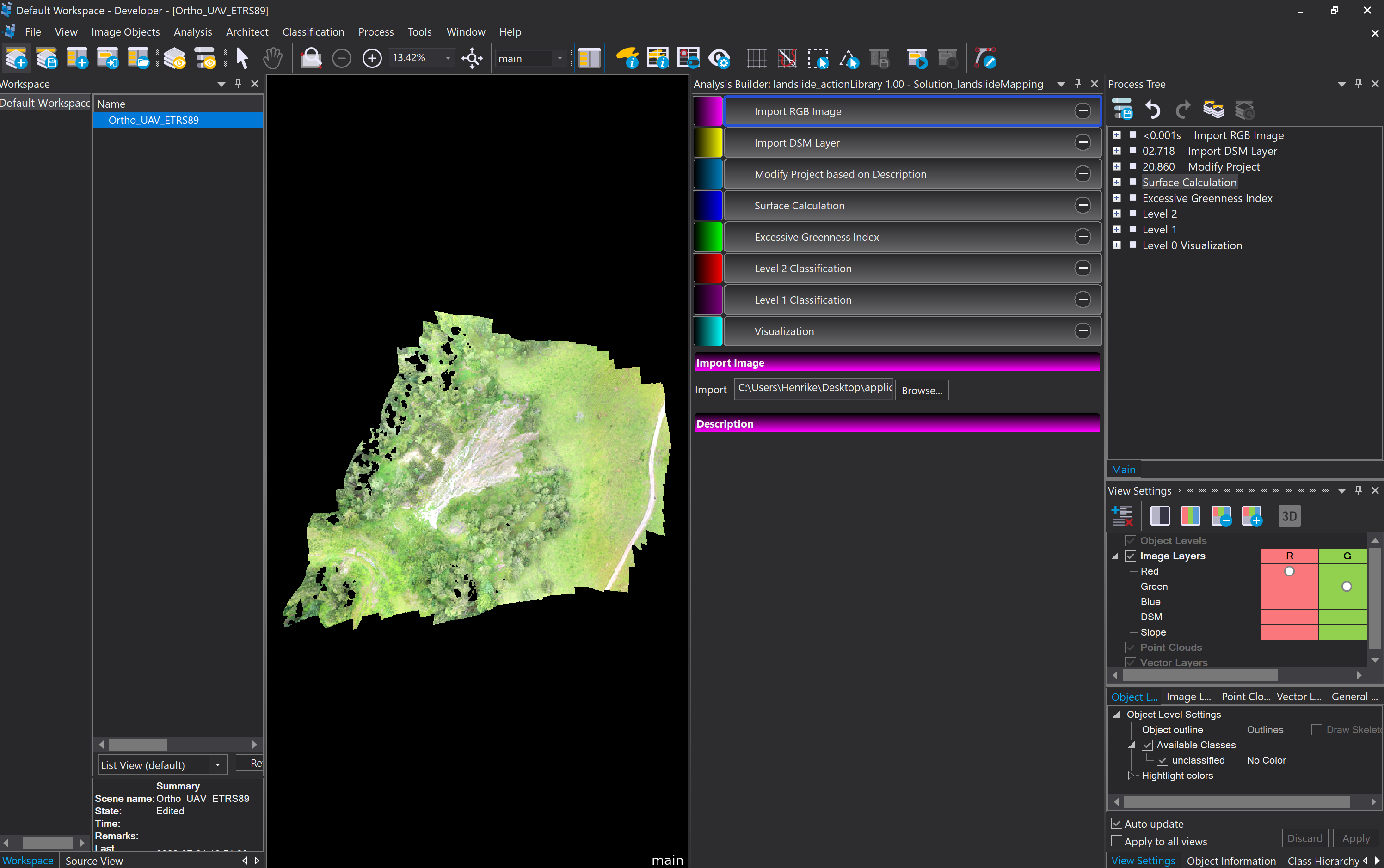
Developing a ruleset and graphical user interface (GUI) for landslide mapping in IP: Application Development (OBIA) course.
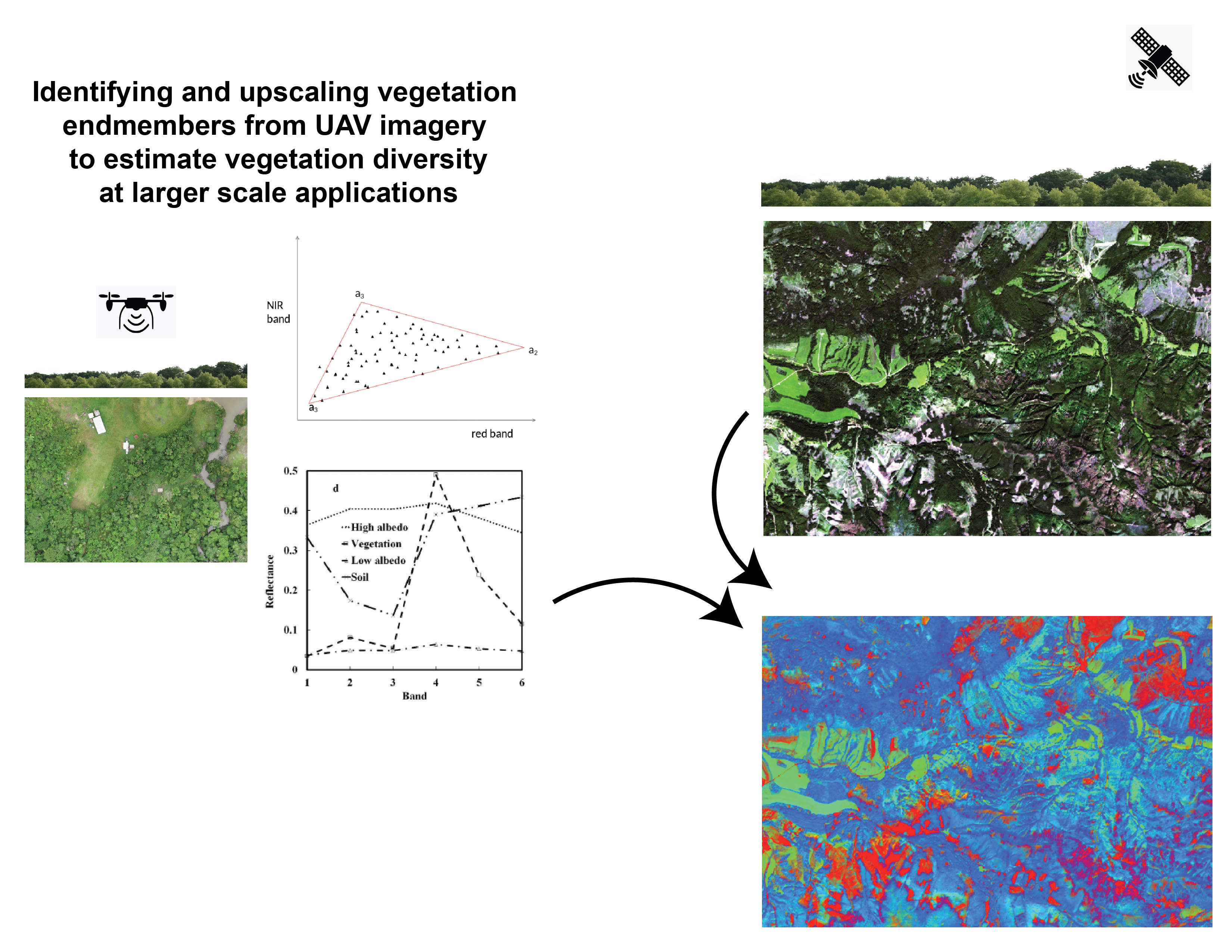
Identifying and upscaling vegetation endmembers from UAV imagery to estimate vegetation diversity at larger scale applications in Software Development course.
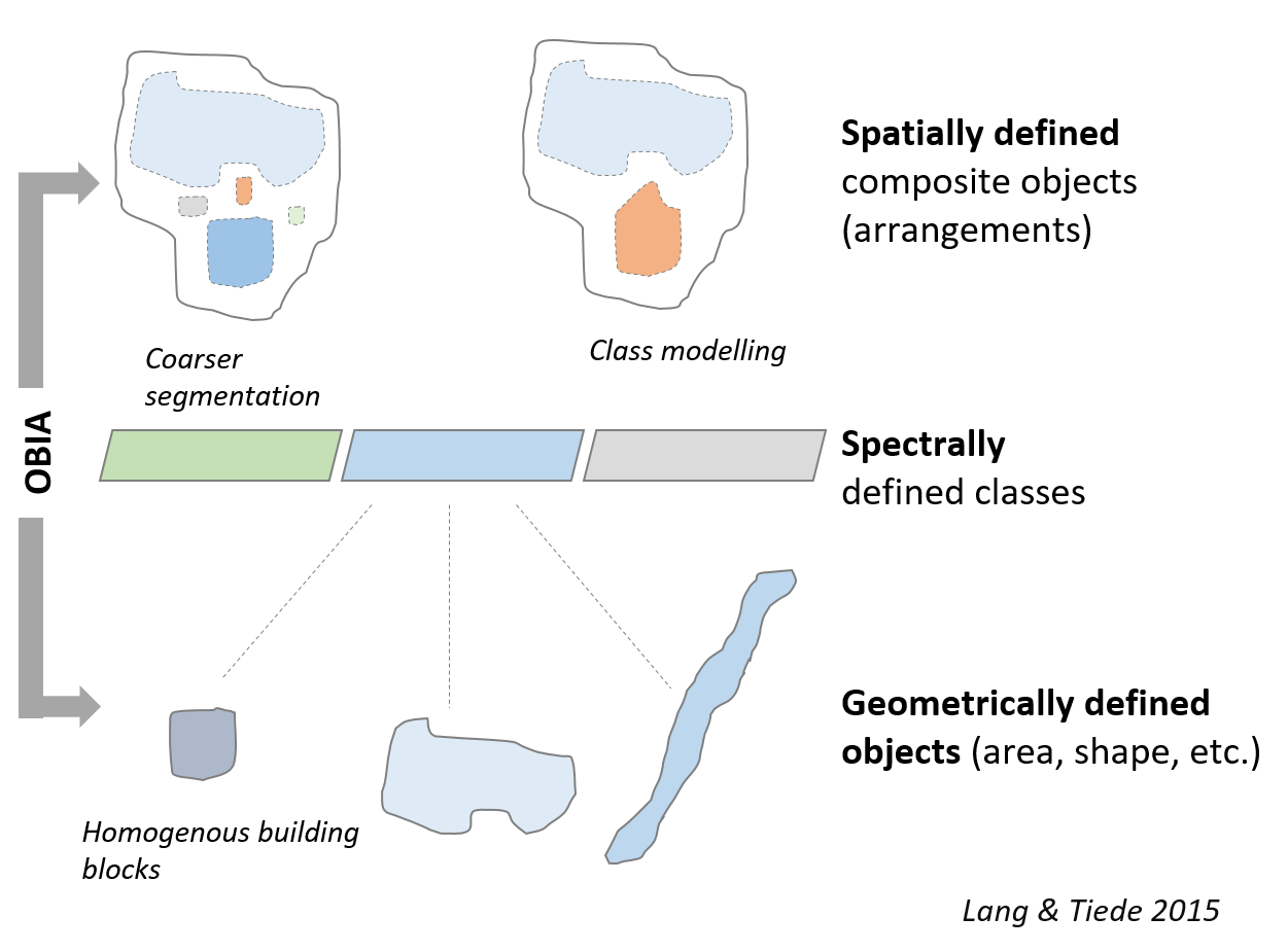
Understanding the principles behind object-based class modeling; from human vision to knowledge-based classification in Analysis and Modeling (Remote Sensing) course.
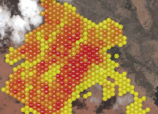
Selected spatial analysis methods to gain insights into the spatial distribution, patterns, and relationships of various phenomena in Methods in Spatial Analysis course.
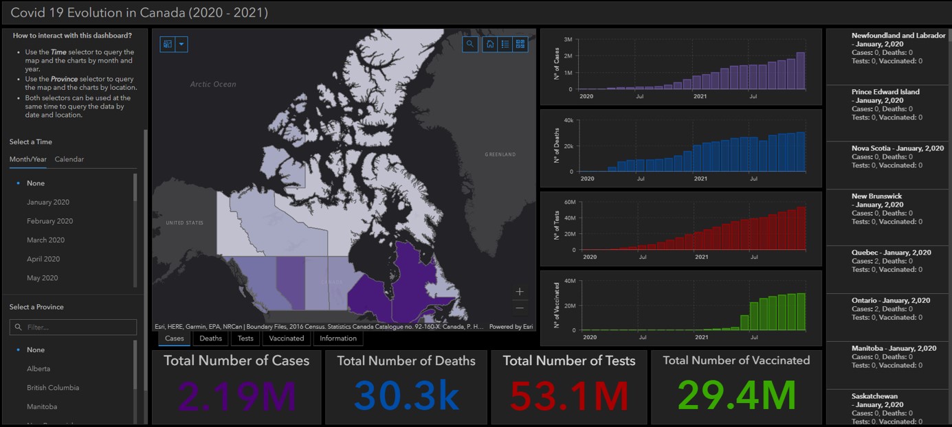
Visualising the spatio-temporal changes of covid-19 data for Canadian provinces in Spatial Data Infrastructure course.
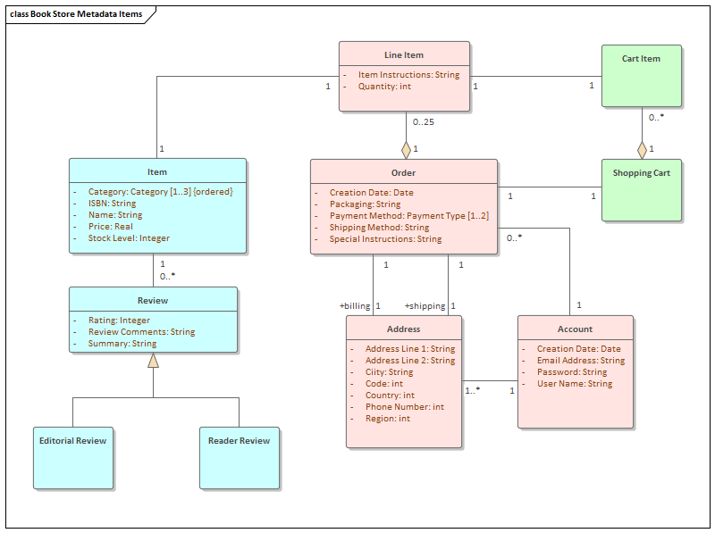
Managing spatial data to store, query, and analyse the datasets in Spatial Databases course.